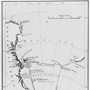
Home > Europe > Russia > Maps
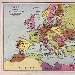
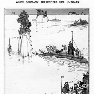
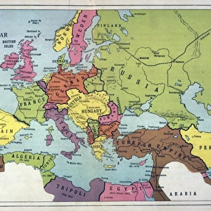
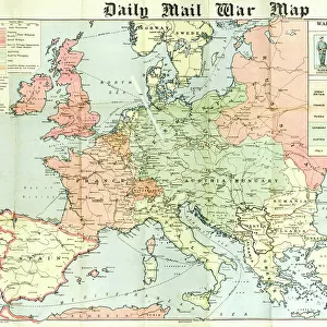
Daily Mail War Map, WW1

Wall Art and Photo Gifts from Mary Evans Picture Library
Daily Mail War Map, WW1
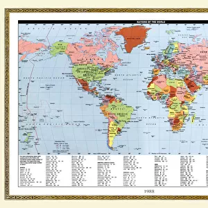
A fold out war map issued by the Daily Mail in the early weeks of the First World War. The map offers statistics regarding the manpower strength of each of the warring nations, as well as the number of battleships and food stores each had. While the Triple Entente of Britain, France and Russia could boast 9, 380, 000 men (of which Britain comprised just 380, 000), the Triple Alliance numbered 9, 500, 000. The map was intended to be marked with Philips flag pins in ten different colours so that civilians could chart the progress of the campaign. Date: 1914
Mary Evans Picture Library makes available wonderful images created for people to enjoy over the centuries
Media ID 14185852
© Mary Evans Picture Library
Battleships Borders Conflict Countries Daily Entente Fold Mail Manpower Maps Nations Outbreak Progress Statistics Strength Triple Warring
FEATURES IN THESE COLLECTIONS
> Europe
> Related Images
> Europe
> Russia
> Related Images
> Historic
> World War I and II
> Civilians during the war
> Maps and Charts
> Early Maps
> Maps and Charts
> Popular Maps
> Maps and Charts
> Related Images
> Popular Themes
> Maps and Charts
EDITORS COMMENTS
This vintage print showcases the Daily Mail War Map of the First World War, published in the early days of the conflict in 1914. The intricately detailed map offers an insight into the military capabilities of the warring nations, with statistics on manpower strength and resources. The Triple Entente, comprised of Britain, France, and Russia, is depicted with a combined total of 9,380,000 men, with Britain contributing 380,000 of that number. In contrast, the Triple Alliance, consisting of Germany, Austria-Hungary, and Italy, boasts a formidable 9,500,000 men. The map was designed to be a personal tool for civilians, with the intention of marking it with Philips flag pins in ten different colors to track the progress of the campaign. This map serves as a poignant reminder of the vast scale and complexity of the European conflict that was to last for the next four years. As the world watched the borders of familiar countries shift and the devastating impact of war unfold, this map offered a visual representation of the statistics behind the headlines. This historical artifact not only offers a glimpse into the military strategies of the time but also serves as a testament to the power of information in shaping public perception during times of crisis.
MADE IN THE USA
Safe Shipping with 30 Day Money Back Guarantee
FREE PERSONALISATION*
We are proud to offer a range of customisation features including Personalised Captions, Color Filters and Picture Zoom Tools
SECURE PAYMENTS
We happily accept a wide range of payment options so you can pay for the things you need in the way that is most convenient for you
* Options may vary by product and licensing agreement. Zoomed Pictures can be adjusted in the Cart.