Home > Europe > United Kingdom > Wales > Ceredigion > Lampeter
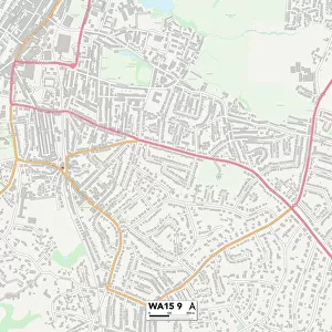
Warrington WA5 9 Map

![]()
Wall Art and Photo Gifts from Map Marketing
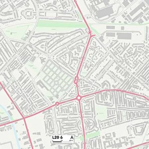
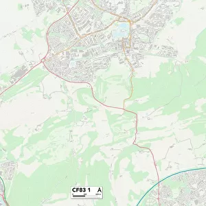
Warrington WA5 9 Map
Postcode Sector Map of Warrington WA5 9
Media ID 19982758
Cabot Close Cardigan Close Carmel Close Cresswell Close Cromwell Avenue Drake Close Grant Close Harlech Close Hudson Close Ladywood Road Langland Close Newbridge Close Old Hall Road Palmer Crescent Raleigh Close Ross Close Shackleton Close St Davids Drive Tenby Close Tintern Close Warrington Willoughby Close Old Hall
FEATURES IN THESE COLLECTIONS
> Arts
> Artists
> W
> Weddell Weddell
> Europe
> France
> Canton
> Landes
> Europe
> United Kingdom
> Scotland
> Dumfries and Galloway
> Newbridge Drive
> Europe
> United Kingdom
> Wales
> Anglesey
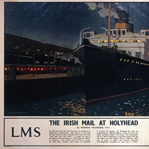
> Holyhead
> Europe
> United Kingdom
> Wales
> Carmarthenshire
> Carmarthen
> Europe
> United Kingdom
> Wales
> Ceredigion
> Cardigan
> Europe
> United Kingdom
> Wales
> Ceredigion
> Lampeter
> Europe
> United Kingdom
> Wales
> Denbighshire
> Corwen
> Europe
> United Kingdom
> Wales
> Denbighshire
> Ruthin
> Europe
> United Kingdom
> Wales
> Denbighshire
> St Asaph
> Map Marketing
> Postcode Sector Maps
> WA - Warrington
MADE IN THE USA
Safe Shipping with 30 Day Money Back Guarantee
FREE PERSONALISATION*
We are proud to offer a range of customisation features including Personalised Captions, Color Filters and Picture Zoom Tools
SECURE PAYMENTS
We happily accept a wide range of payment options so you can pay for the things you need in the way that is most convenient for you
* Options may vary by product and licensing agreement. Zoomed Pictures can be adjusted in the Cart.