Home > Europe > United Kingdom > England > Sussex > Colworth
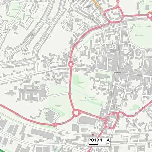
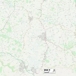
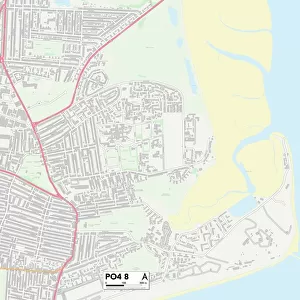
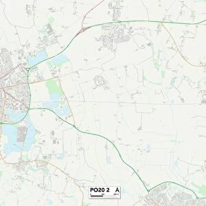
Sussex PO20 2 Map

![]()
Wall Art and Photo Gifts from Map Marketing
Sussex PO20 2 Map
Postcode Sector Map of Sussex PO20 2
Media ID 19976606
Bankside Barncroft Close Bishops Road Briar Close Campbell Road Chestnut Walk Chichester Drive Church Lane Coach Road Copper Beech Drive Derwent Close Drayton Lane Duxford Close Gibson Road Ham Lane Heron Close High Street Highfield Lane Lysander Way Malcolm Road Marlpit Lane Marsh Lane Meadow Way Merlin Close Middleton Gardens Nelson Close Oakwood Close St Andrews Close St Andrews Lane Sunderland Close Sussex The Glebe Waterside View Wellington Place Western Road Windmill Drive Woodfield Close Wyvern Close Elbridge Tangmere
FEATURES IN THESE COLLECTIONS
> Animals
> Birds
> Coraciiformes
> Kingfishers
> Related Images
> Animals
> Birds
> Herons
> Related Images
> Animals
> Crustaceans
> Gribble
> Animals
> Insects
> Spiders
> Silver Garden
> Europe
> United Kingdom
> England
> Cheshire
> Related Images
> Europe
> United Kingdom
> England
> Sussex
> Chichester
> Europe
> United Kingdom
> England
> Sussex
> Colworth
> Europe
> United Kingdom
> England
> Sussex
> Nyton
> Europe
> United Kingdom
> England
> Sussex
> Oving
> Europe
> United Kingdom
> England
> Sussex
> Related Images
> Map Marketing
> Postcode Sector Maps
> PO - Portsmouth
> Map Marketing
> UK Maps
MADE IN THE USA
Safe Shipping with 30 Day Money Back Guarantee
FREE PERSONALISATION*
We are proud to offer a range of customisation features including Personalised Captions, Color Filters and Picture Zoom Tools
SECURE PAYMENTS
We happily accept a wide range of payment options so you can pay for the things you need in the way that is most convenient for you
* Options may vary by product and licensing agreement. Zoomed Pictures can be adjusted in the Cart.